M/Y LIVA · A Voyage Among Fjords, Ice & Norse Ruins

South Greenland

Aboard M/Y LIVA, 16 – 29 August 2026. A voyage among fjords, ice and Norse ruins: fourteen days round-trip from Qaqortoq, from the granite walls of Tasermiut and the wild, ice-bound east coast to the hot spring at Uunartoq and the thousand-year-old ruins of the Eastern Settlement.

13
Nights · Qaqortoq round-trip
14
Days
3
UNESCO Norse sites · Kujataa
A Coast Deeply Incised

Where
Ice
Meets
Sea

The coast of South Greenland is deeply incised on every side, by fjords and channels that run far inland past walls of gneiss and granite, some of the oldest rock on Earth, to tidewater glaciers and the edge of the icecap itself. In late summer the tundra turns to full colour, and lengthening evenings bathe the landscape in low golden light.

Arctic peoples had been living in Greenland for thousands of years before Norse settlers arrived from Iceland in the tenth century. The Norse farmed and traded here for nearly five hundred years before vanishing from the record, and their ruins still stand among the working sheep farms of communities where Inuit tradition and Danish influence weave into something distinctly Greenlandic.

The wildlife here is unmanaged: whales feeding in the fjords, eagles on the cliffs, seals hauled out on drifting ice, and the possibility of high-Arctic species on the icy east coast. Encounters come on nature's terms.

16 Aug
Embark · Qaqortoq
29 Aug
Disembark · Qaqortoq
Tasermiut
Granite walls of the south
1408
Last Norse record · Hvalsey
The Four Legs

The Voyage,
Region by Region

01Leg One
16 – 17 Aug
16 – 17 August · Days 1 – 2

The Southern Fjords

Qaqortoq → Nanortalik → Tasermiut Fjord

The voyage begins with a flight from Keflavik to embark LIVA at Qaqortoq, the largest town of the south. LIVA makes south to Nanortalik at the continent's tip, then up Tasermiut Fjord, often compared to Yosemite, where granite walls climb to spires above two thousand metres.

02Leg Two
18 – 22 Aug
18 – 22 August · Days 3 – 7

Prins Christian Sund & the East Coast

Aappilattoq → the East Coast → back west

East through Prins Christian Sund, a channel rarely more than a kilometre across cutting through the mountain spine, past the stacked houses of Aappilattoq. Then three days exploring the fjords of the wild, virtually uninhabited east coast, the nearest settlement 700 kilometres away: whales and drifting Arctic pack, kayaking among icebergs, and helicopter flights to the ice-cap fringe, before the westbound return through the sound under a different light.

03Leg Three
23 – 25 Aug
23 – 25 August · Days 8 – 10

The Norse Heartland

Uunartoq → Igaliku · Garðar → Qassiarsuk · Narsarsuaq

The inner fjords of the old Norse Eastern Settlement. A bathe in the geothermal springs at Uunartoq, the cathedral ruins of Garðar at Igaliku, seat of Greenland's medieval bishopric, and Erik the Red's Brattahlíð at Qassiarsuk, beside the wartime airfield of Narsarsuaq and the ice-choked Qooroq fjord.

04Leg Four
26 – 29 Aug
26 – 29 August · Days 11 – 14

The Return

Nordre Sermilik → Narsaq → Hvalsey → Qaqortoq

A day given entirely to landscape in Nordre Sermilik, the tidewater calving front of the Qalerallit glacier and the working town of Narsaq, then a last walk among the full-height gable walls of Hvalsey, where the Norse record went silent in 1408, before LIVA returns to Qaqortoq and guests fly home.

Route Map

Qaqortoq Round-Trip
The Fjords of South Greenland

Thirteen nights south from Qaqortoq through Prins Christian Sund to the ice of the east coast, then back through the Norse heartland of the Eastern Settlement. Click any stop on the map to dive in.

Click to interact
Right click and drag or pull to get 3D
Knowledge Across the Voyage

Four Threads
Through the South

Thread 01
Ice
& Glaciers
The inland ice sheet stands behind everything, its outlet glaciers calving into the fjords. Walls of gneiss and granite that predate complex life on Earth flank Prins Christian Sund; the Sermitsiaq, Qalerallit and east-coast glaciers reach the sea, their blue ice weathered to caverns, arches and overhangs at close range.
Thread 02
Arctic
Wildlife
Humpback and minke whales work the productive east-coast waters; harbour and harp seals haul on the floes; white-tailed eagles, Greenland's largest raptor at over two metres, quarter the cliffs; and along the drifting pack, polar bear is a genuine possibility. Ashore, Arctic fox and snow bunting on a late-summer tundra of crowberry and cloudberry.
Thread 03
Fjords
& Hiking
The granite verticality of Tasermiut, glacier hikes onto the ice cap in the Lindenow permit area, kayaking among the icebergs, and gentler tundra walks and gravel-bike rides through the old Norse farming country, with helicopter access to terrain that would otherwise take days to reach on foot.
Thread 04
Norse &
Greenlandic Life
Kujataa, the UNESCO World Heritage landscape of Norse and Inuit farming: Erik the Red's Brattahlíð at Qassiarsuk, the bishopric of Garðar at Igaliku, and the full-height church at Hvalsey where the record ends in 1408, alongside the working towns of Qaqortoq and Narsaq today.

"The wildlife here is unmanaged. Encounters come on nature's terms."

South Greenland Expedition · M/Y LIVA
Leg 01 · The Southern Fjords

Qaqortoq,
Nanortalik & Tasermiut

16 Aug · Embark · Day 1
Qaqortoq

Fly from Keflavik to Greenland to embark LIVA at Qaqortoq, whose name means 'the white one' in Kalaallisut. It is the largest town in southern Greenland, home to around three thousand people on a hillside above a protected harbour. Either today or later in the trip there is time for a walk through the town, where the Stone and Man project has set over thirty sculptures carved directly into the rock, works by Greenlandic, Danish and international artists placed into the landscape rather than mounted on pedestals. Local craft workshops offer sealskin work, tupilak carvings and woven textiles.

17 Aug · Day 2
Highlight
Nanortalik · Tasermiut Fjord

LIVA makes south toward Nanortalik, 'the place of polar bears', the southernmost town in Greenland, set among a scatter of low islands at the continent's tip: a small, self-sufficient community, its colourful houses backed by peaks that rise steeply from the fjord. A walk through town and the open-air museum gives context to a place that has lived by fishing and hunting for generations. The greater scenery lies inland, up Tasermiut Fjord, often compared to Yosemite: a narrow arm of water flanked by granite walls that climb to spires and summits above two thousand metres, popular with climbers from around the world. The Sermitsiaq glacier descends to the valley floor, streaked with moraine, and lower tundra hikes pass through crowberry, cloudberry and Arctic heather. Helicopter access opens terrain that would otherwise take days to reach on foot.

Leg 02 · Prins Christian Sund & the East Coast

The Sound &
the Wild East Coast

18 Aug · Day 3
Prins Christian Sund (Eastbound)

Prins Christian Sund, 'Ikeq' in Kalaallisut, is one of Greenland's most scenic passages: a narrow channel rarely more than a kilometre across, cutting through the mountain spine of the south, separating the mainland from a large outlying island and connecting the east and west coasts. Walls of banded gneiss rise hundreds of metres on either side, waterfalls thread down from the plateau, and the water is dotted with bergy bits and growlers calved from glaciers at the channel's edges. Along the way there are hikes along the shoreline, tender cruises into the quieter arms, and a stop at Aappilattoq, a hunting community of around a hundred and seventy people on a rocky slope halfway through the channel, reachable only by boat or helicopter. At the end of the day LIVA emerges on the wild east coast.

19 – 21 Aug · Days 4 – 6
Highlight
Exploring the East Coast

Conditions permitting, LIVA spends three days exploring the fjords of the southern east coast, a very different environment from the west. The shoreline feels the East Greenland Current, which carries cold water and pack ice south from the Arctic Ocean, so the ice is denser and more variable and the temperatures noticeably cooler. Virtually uninhabited, with the nearest settlement 700 kilometres to the north, this is one of the most sparsely visited coastlines in Greenland, the quiet broken only by wind and the distant sound of calving ice. It is also some of the richest wildlife territory in the south: humpback and minke whales in the productive waters, harbour and harp seals on the floes, and white-tailed eagles working the cliffs. Polar bear, though rare this far south, is a genuine possibility on the east coast, and precautions are taken whenever ashore. The days are shaped by ice and weather: kayaking among icebergs at water level, hikes along the fjord margins, helicopter flights up to the ice-cap fringe, and tenders working the brash ice in search of wildlife.

22 Aug · Day 7
Prins Christian Sund (Westbound)

The westbound return through Prins Christian Sund shows the same geography under different light. The passage is unhurried, with stops for hikes along the shoreline, tender cruises into the branching arms of the channel, and helicopter flights over the plateau above.

Leg 03 · The Norse Heartland

Uunartoq, Garðar
& Brattahlíð

23 Aug · Day 8
Highlight
Sermilik Fjord · Uunartoq

The inner fjord systems of the south offer a change of pace after the open coast. Sermilik Fjord has good hiking and glacier access, on a more intimate scale than the east coast. Continuing north, LIVA calls at Uunartoq, a small island whose natural geothermal hot springs have drawn visitors for centuries. The pools sit at the fjord's edge, warmed to bathing temperature by volcanic activity beneath the bedrock, surrounded by cold fjord water, drifting icebergs and granite peaks. Bathing here, warm water against a backdrop of Arctic scenery, is one of the more distinctive experiences on this coast.

24 Aug · Day 9
Highlight
Igaliku Fjord · Garðar

The Norse called this place Garðar and made it the seat of Greenland's medieval bishopric. From the early twelfth century until the Norse colonies disappeared from the record in the fifteenth, Garðar was the spiritual and administrative centre of European settlement at the edge of the known world: a cathedral, a bishop's farm and a tithe barn, all built at a fjord-head at sixty-one degrees north. The ruins stand today in the grass above Igaliku Fjord, the cathedral's foundations traceable in the turf, the walls of the bishop's farm still identifiable. The surrounding land is unusually lush by Greenlandic standards, thanks to south-facing slopes that catch the long August sun. It is one of the more puzzling chapters in northern history: an ambitious settlement that, in the end, vanished almost without a trace.

25 Aug · Day 10
Highlight
Qassiarsuk · Narsarsuaq · Qooroq

Across Tunulliarfik Fjord from Igaliku lies Qassiarsuk, where Erik the Red established Brattahlíð, the farm that served as the base for Norse expansion into Greenland and, eventually, the first European landfall in North America. A reconstructed longhouse and a replica of Leif Eriksson's church give physical form to a history otherwise known mainly through the sagas, and the valley is still farmed, sheep grazing the meadows that once supported Norse cattle. At the head of the same fjord sits Narsarsuaq, with a very different, much more recent past: built from 1941 by the US Army as Bluie West One, it became a key link in the North Atlantic air-ferry route in the Second World War, with thousands of aircraft passing through and a wartime population of around four thousand American servicemen. The US Air Force held it as a Cold War refuelling stop before handing it to Danish control in 1958, and the village museum covers both the wartime and the Norse history. Nearby, the Qooroq ice fjord is a different spectacle: a narrow arm packed with calved ice drifting seaward, the glacier visible at its head.

Leg 04 · The Return

Nordre Sermilik,
Narsaq & Hvalsey

26 Aug · Day 11
Nordre Sermilik Fjord

Some days on this voyage are given over entirely to landscape rather than a specific site. Nordre Sermilik Fjord offers tundra slopes in late-summer colour and glacial valleys descending from granite peaks, with no scheduled programme beyond what the terrain and weather suggest. The hillsides are turning as the season shifts, patches of russet and amber appearing among the greens, the crowberry ripening. Hiking here is exploratory rather than directed, with no marked trails, and helicopter flights over the surrounding fjord and plateau give a sense of the scale of the country. By evening the vessel typically sits at anchor in calm, ice-free water.

27 Aug · Day 12
Nordre Sermilik · Narsaq

The morning is spent at the Qalerallit glacier, one of the more accessible tidewater glaciers in the south. A tender cruise along the calving front brings guests close to the ice face, ten to thirty metres above the waterline with unknown depths below, and the face is active, with periodic calving audible well before it is seen. Later, LIVA calls at Narsaq, home to around fifteen hundred residents and one of the south's larger towns: a working community known for livestock farming, helped by one of Greenland's milder microclimates, and for nearby geology unusually rich in rare earth minerals. The setting of fjord and peak on every side is simply the everyday backdrop here.

28 – 29 Aug · Days 13 – 14
Highlight
Hvalsey · Qaqortoq

Hvalsey Church is the best-preserved Norse structure in Greenland and one of the more historically significant buildings in the North Atlantic, its gable walls standing to full height on a grassy headland above Hvalsey Fjord. It was here, in September 1408, that the last documented record of the Greenland Norse was written, an account of a wedding, after which the colony disappears from history. After time among the ruins, LIVA returns to Qaqortoq for a final evening in port: coffee and cake with locals, a Greenlandic tradition of relaxed hospitality, and a chance to sample local produce, dried fish, tundra-raised lamb and crowberry preserves. The next morning, guests disembark and travel by vehicle or helicopter to the airport for a charter flight to Iceland and the journey home.

The Yacht

M/Y LIVA

M/Y LIVA is a private expedition yacht of approximately 120 metres, chartered for this voyage through EYOS.

She carries the tenders, zodiacs and helicopter that make a coast like this reachable: long tender runs into the permit-controlled fjords of the east, zodiac cruises among the ice, and heli-hikes and sightseeing over the glaciers and the inland ice.

Full specification, cabin plan and crew to follow.

Your Expedition Team

Polar Guides,
Greenland-Tested

Expedition Leader

Catherine Buckland

Catherine Buckland is a commercial diving instructor and diver medic based in Plymouth, England. She has spent her career training elite divers, including teams from the British Antarctic Survey and the UK military, and leading scientific and expedition projects worldwide.

With EYOS she supervises dives in the polar regions, in some of the most remote and demanding waters on the planet, thriving on managing challenging conditions and giving guests great experiences on and under the ice.

Expedition Guide

Aviaaja Schülter

Aviaaja Schülter is an EYOS expedition guide and photographer whose work in the Arctic ranges across Greenland and the Northwest Passage.

Full biography to follow.

Before You Sail

The Packing List

Layers are everything. South Greenland in late August runs cool and changeable: clear and mild one hour, wind and rain off the ice the next. Pack for wet zodiac landings and bright glare on the water. Tick items off as you go: your progress is saved on this device.

Expect average temperatures between 2°C – 10°C (36 – 50°F), colder on the water and the east-coast ice, and conditions that change fast. Dress in layers so you can adjust through the day. A typical dress for a landing:

Top

Bottom

Expedition Clothing

Equipment & Personal

Documents & Logistics

For the Voyage

Recommended Reading
and Viewing

A short shelf for the days at sea. The first three are the classics of the north; the last three carry you into the Norse history of the exact coast you sail, between Qaqortoq and the fjords of the old Eastern Settlement.
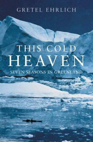
This Cold Heaven book cover
This Cold Heaven
Gretel Ehrlich

Seven seasons in Greenland. The best single book for understanding the land, the ice, and the Inuit communities you will pass.
Find the book →
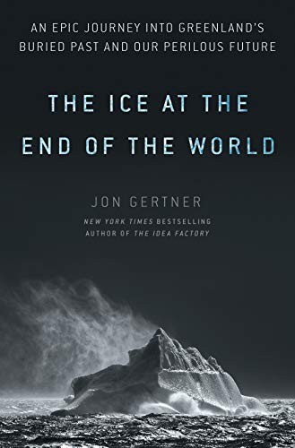
The Ice at the End of the World book cover
The Ice at the End of the World
Jon Gertner

The story of the Greenland Ice Sheet, from Nansen's first crossing to the satellite era. Read it before you see the ice for yourself.
Find the book →
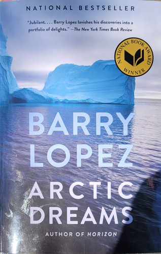
Arctic Dreams book cover
Arctic Dreams
Barry Lopez

The definitive literary account of the far north and a National Book Award winner. Still the place to start.
Find the book →
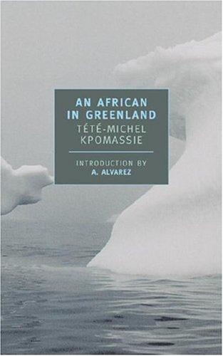
An African in Greenland book cover
An African in Greenland
Tété-Michel Kpomassie

A teenager from Togo reads a book about Greenland and spends years working his way north. A warm, beloved Arctic travelogue.

Find the book →
The Greenlanders book cover
The Greenlanders
Jane Smiley

A sweeping novel of the Norse who farmed this exact coast, set in the medieval Eastern Settlement you sail past near Qaqortoq.

Find the book →
The Vinland Sagas book cover
The Vinland Sagas
Penguin Classics

The Saga of the Greenlanders and Erik the Red's Saga. Erik settled this very coast around 985; his ruins still stand near Qaqortoq.

Find the book →

Recommended Viewing

Field Optics & Gear

Binoculars,
Scopes & Tripods

Binoculars are essential for quality viewing of distant wildlife and birds, and you will use them often, so it is worth investing in a quality pair. The first number is magnification, the second the front-lens diameter in millimetres; 8×42 or 10×42 are popular all-round choices. A short list across price ranges follows. For high-end options or individual advice, contact us.

Binoculars

Zeiss Conquest 10x42 HD binocular
Zeiss Conquest 10×42 HD

A golden-mean objective that still gathers light at dawn and dusk. Waterproof to 13', nitrogen-filled and fog-proofed, with HD glass and up to 90% light transmission.

Approx. $999.99 USD
View product →
Vortex Razor HD 10x42 binocular
Vortex Razor HD 10×42

A step up, with a best-in-class HD optical system for the sharpest images in its class, covered by Vortex's lifetime warranty.

Approx. $1,299.99 USD
View product →
Leica Trinovid 10x42 HD binocular
Leica Trinovid 10×42 HD

Phase-corrected, multi-coated prisms for high-contrast, true-colour images. A light magnesium chassis with rubber armour, waterproof and fog-proof, plus Leica's Adventure Strap system.

Approx. $999.00 USD
View product →
Nikon Monarch 5 10x42 binocular
Nikon Monarch 5 10×42

Fully multicoated ED-glass optics and phase-corrected roof prisms in a rubber-armoured, fog-proof housing. A 5.5° field of view that focuses to within nine feet.

Approx. $296.95 USD
View product →
Bushnell 12x42 H2O Porro binocular
Bushnell 12×42 H2O Porro

A compact, weather-sealed, fog-proof body with multicoated BAK4 prism glass for clear, bright, detailed images.

Approx. $99.99 USD
View product →

Image-stabilised binoculars are available but tend to be expensive and heavy, so they are not included here.

Spotting Scopes

Weigh portability against light-gathering: smaller 60–66 mm bodies travel easily, while larger objectives are brighter at distance and in low light. Angled eyepieces suit comfort, straight bodies are easier for beginners to aim. Eyepieces are sold separately on the Kowa models.

Kowa TSN-601 / 602 60mm spotting scope
Kowa TSN-601 / 602 · 60 mm

A mid-sized 60 mm objective with good light-gathering in a compact, waterproof, fog-proof body. The 601 is angled, the 602 straight; eyepiece purchased separately.

Approx. $500 USD
View product →
Kowa TSN-773 / 774 Prominar XD 77mm spotting scope
Kowa TSN-773 / 774 Prominar XD · 77 mm

XD (extra-low dispersion) glass and Kowa's C3 multi-coatings minimise chromatic aberration for crystal-clear, high-contrast images, in a magnesium-alloy body. The 773 is angled, the 774 straight; eyepiece required.

Approx. $1,549 / $1,600 USD
View product →
Vortex Razor HD 27-6085 spotting scope
Vortex Razor HD 27-6085

A high-end scope: advanced optics deliver distortion-free, flat-field images with edge-to-edge sharpness, strong resolution and colour accuracy.

Approx. $1,999.99 USD
View product →

Tripods

A good tripod that can carry a heavy scope is essential, since scopes are used mostly aboard. Heads are sold separately: look for a ball or video head that pans and tilts rather than a fixed camera head.

Manfrotto MT055XPRO3 aluminium tripod
Manfrotto MT055XPRO3 Aluminium

A three-section support with a 19.8 lb load capacity that extends from 3.5" to 66.9". Quick Power Locks add rigidity, a centre column swings horizontal for low-angle work, and a 360° bubble level sits on the head mount.

Approx. $208.87 USD
View product →
Capturing the Trip

Photography

The light, the wildlife and the ice make South Greenland one of the most rewarding places to photograph. A few things worth knowing before you sail.

In the Field

For the camera and lenses you bring on deck and ashore.

  • A super-wide lens is ideal for the vast landscapes.
  • For distant wildlife such as whales and seabirds, a fast, long lens or high zoom helps; image-stabilised lenses are recommended.
  • Cold saps battery power: carry spares, and keep batteries close to your body to stay warm.
  • Rain and sea spray are constant, so keep your gear in waterproof bags.
  • Keep your camera on a strap on deck to avoid dropping it.
  • Mind the weight of the gear you carry ashore.
  • A tripod helps ashore but not on a moving vessel; a monopod or beanbag steadies shots aboard.
  • Onboard internet is limited, so plan to keep photos on your phone or laptop. Recreational drones are not permitted in the Arctic (AECO).

On Your Phone

Tips for shooting on a phone.

  • Tap to set focus, then nudge exposure down a touch: bright snow and ice fool auto-exposure and leave shots grey and flat.
  • Turn on the grid and keep the horizon level; on open water a tilted horizon is the giveaway of a rushed shot.
  • Use burst mode for wildlife and breaching whales: hold the shutter, pick the best frame later.
  • Carry a microfibre cloth; sea spray on the lens is the most common reason a phone shot comes out soft.
  • Cold drains phone batteries fast, so keep your phone in an inside pocket and bring a power bank ashore.
  • In the long Arctic light, shoot toward the low sun and lock exposure on the brightest part of the sky for richer colour.
For Further Information

Plan the
South Greenland Voyage

A round-trip from Qaqortoq aboard M/Y LIVA, 16 – 29 August 2026. Fourteen days through the fjords, ice and Norse ruins of South Greenland.

EYOS Expeditions
ian@eyos.com · www.eyos.com

All itineraries are subject to modification by the Captain and Expedition Leader based on weather, ice, sea state and wildlife opportunity. Permit-controlled areas on the east coast require advance authorisation and are subject to seasonal and environmental conditions. The itinerary reflects planned intent; the voyage's value lies in its capacity to respond to what the landscape offers.